

Последняя версия
Версия
2.0.17
2.0.17
Апдейт
май 06, 2025
май 06, 2025
Разработчик
GeoFS Development
GeoFS Development
Категории
Игры
Игры
Платформы
Android Apps
Android Apps
Загрузки
0
0
Лицензия
Бесплатно
Бесплатно
Название пакета
com.geofs.sr
com.geofs.sr
Репорт
Сообщить о проблеме
Сообщить о проблеме
Подробнее о GeoFS - Flight Simulator
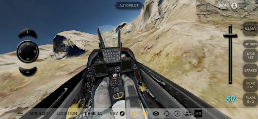
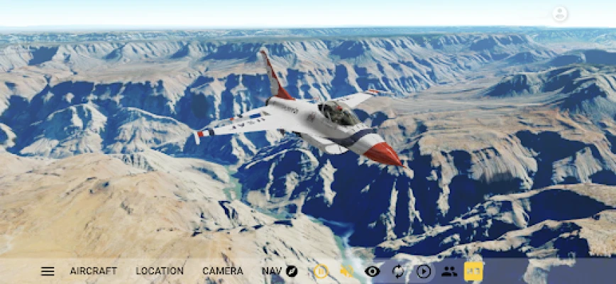
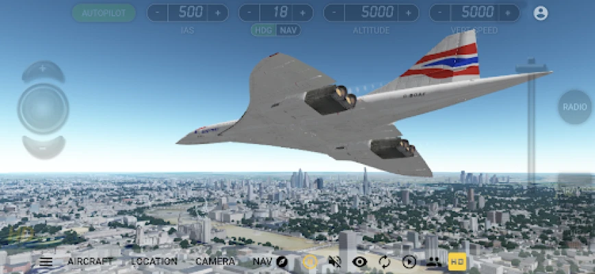
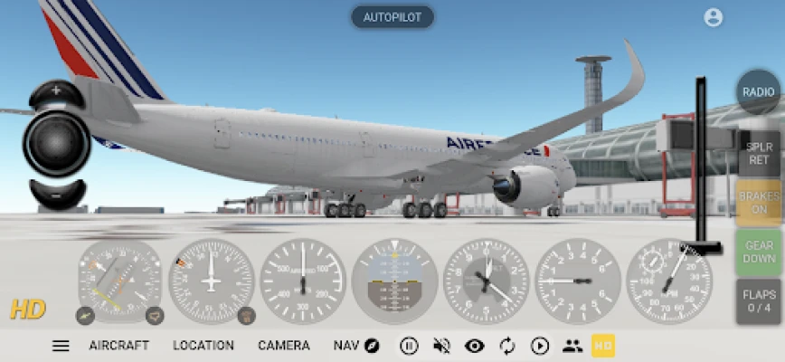
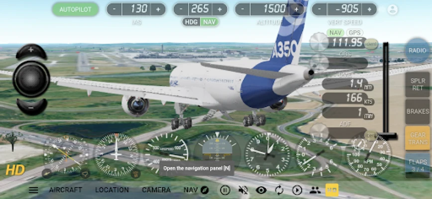
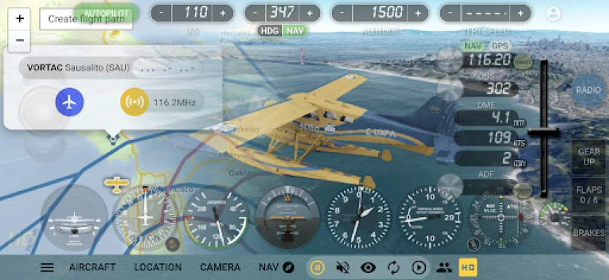
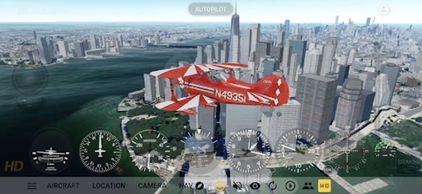
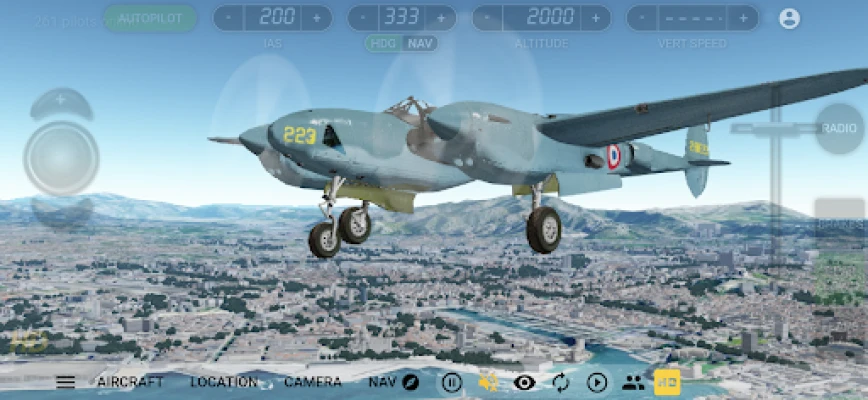
GeoFS is a multiplayer flight simulator displaying a global scenery from satellite images. Whether you are a licensed pilot practicing VFR, an aviation enthusiast or just looking for some fun flying in beautiful landscapes, you can enjoy any of the 30 available aircraft, ranging from paraglider to airliners, absolutely anywhere in the world..
This app includes:
- Worldwide 1m/pixel Super Resolution imagery - AI enhanced satellite images
- Worldwide (10m resolution) satellite images and elevation model
- Realistic physics and flight models
- Global multiplayer
- Navigation charts with 40,000 referenced runways
- Radio Navigation (GPS, ADF, VOR, NDB, DME)
- 30+ different aircraft with instrumented cockpits
- ADS-B real-life commercial traffic
- Replay mode
- Seasons, day/night and real-time weather conditions from METAR (wind, clouds, fog, precipitations)
Included aircraft:
- Piper J3 Cub
- Cessna 172
- Dassault Breguet / Dornier Alpha Jet
- Boeing 737-700
- Embraer Phenom 100
- de Havilland DHC-6 Twin Otter
- F-16 Fighting Falcon
- Pitts Special S1
- Eurocopter EC135
- Airbus A380
- Alisport Silent 2 Electro (Motor Glider)
- Pilatus PC-7
- de Havilland DHC-2 Beaver
- Colomban MC-15 Cri-cri
- Lockheed P-38 Lightning F-5B
- Douglas DC-3
- Sukhoi Su-35
- Concorde
- Piper PA-28 161 Warrior II
- Airbus A350
- Boeing 777-300ER
- Boeing F/A-18F Super Hornet
- Beechcraft Baron B55
- Potez 25
- Major Tom (Hot Air Balloon)
- And more...
An internet connection is necessary to run GeoFS.
Оцените приложение
Добавить комментарий и отзыв
Отзывы пользователей
Основано на 0 reviews
Отзывов пока не добавлено.
Комментарии не будут допущены к публикации, если они являются спамом, оскорбительными, не по теме, содержат ненормативную лексику, содержат личные выпады или разжигают ненависть любого рода.


Ещё »

Популярные приложения!

MarinaСорокин Дмитрий Олегович (@sorydima)

Marina for HUAWEIСорокин Дмитрий Олегович (@sorydima)

MarinaСорокин Дмитрий Олегович (@sorydima)

TMA For Basique 7.13Сорокин Дмитрий Олегович (@sorydima)
REChain TMAСорокин Дмитрий Олегович (@sorydima)
Basique 7.13 For Aurora OSСорокин Дмитрий Олегович (@sorydima)
REChain ®️ 🪐Сорокин Дмитрий Олегович (@sorydima)

Katya ® 👽Сорокин Дмитрий Олегович (@sorydima)

Катя ® 👽 for SlackwareСорокин Дмитрий Олегович (@sorydima)

Катя ® 👽Сорокин Дмитрий Олегович (@sorydima)
Ещё »
Выбор редактора
TMA For Basique 7.13Сорокин Дмитрий Олегович (@sorydima)
Basique 7.13 For Aurora OSСорокин Дмитрий Олегович (@sorydima)

Basique 7.13Сорокин Дмитрий Олегович (@sorydima)

My Modus For Aurora OSСорокин Дмитрий Олегович (@sorydima)

Marina For Aurora OSСорокин Дмитрий Олегович (@sorydima)
Катя ® 👽 for SlackwareСорокин Дмитрий Олегович (@sorydima)
REChain for Aurora OSСорокин Дмитрий Олегович (@sorydima)
REChain TMAСорокин Дмитрий Олегович (@sorydima)

MyModus FashionСорокин Дмитрий Олегович (@sorydima)

My ModusСорокин Дмитрий Олегович (@sorydima)
Все платформы »
 Web PWA
 HARMONY OS
 ОС Аврора
 Polkadot
 Ethereum
 BNB
BNB Base Blockchain
 Polygon
 Gnosis
 Arbitrum
 Linea
Linea Moonbeam
 Aptos
Aptos Solana
 THORChain
 TONChain
 PYTH Network